Mt. Katahdin Hiking Guide

Mt.Katahdin is the heart of Baxter State Park. It brings in visitors and often local hikers wills summit a few times a year. There are multiple routes to summit Mt.Katahdin, and they are all beautifully difficult. Mt. Katahdin has two major peaks, Baxter Peak at 5,267 feet in elevation and Pamola at 4,919 feet. The average round trip hiking both peaks is about 10 miles give or take.
Planning:
When you choose which trail you’d prefer to hike, you need to check out the parking reservations and pass system. Baxter State Park is very strict on their parking policies, so you will need a pass to hike Mt. Katahdin if you are not camping within the park. If you live in the state your park access is free, and it is $5 per car to reserve a spot. If you do not want to reserve a spot, you can show up the day of and *may possibly* get a spot. The line of cars arrives outside the gate very early and if you are too deep in line you won’t get a spot. They start giving away unreserved spots at 6:00 am, but if everything is fully reserved they wait until there are no-shows beginning at 7:05 am.
Factor more time for driving into your “Away from home” time. I have a tendency to calculate my drive time from my home base to the trailhead into my hike time. This is mostly because I don’t like leaving Riley (our dog) for over 8 hours at a time. Between the time you spend waiting at the gatehouse in the morning and the roughly 40-minute drive from the gatehouse to the trailheads you’re adding more time to your day. Say you hike for 9 hours and drive for 3, that’s a 12-hour day instead of a 9-hour day.
Time of Year: Mt. Katahdin is a big, dangerous mountain. It may be sunny and nice at the base but cloudy, cold, and wet above the tree line. Make sure you check in with a ranger before your hike to make sure you are prepared for the weather.
Trails:
This mountain is not easy, and the labeled easiest trails up are debated. Among the list of “easiest trails up” would be the Hunt Trail, Saddle Trail and Hamlin Ridge. These don’t include your journey across the mountain and your way down.
Depending if you choose to do one peak and then descend, or do both peaks you will need to choose a trail to cross the ridge.

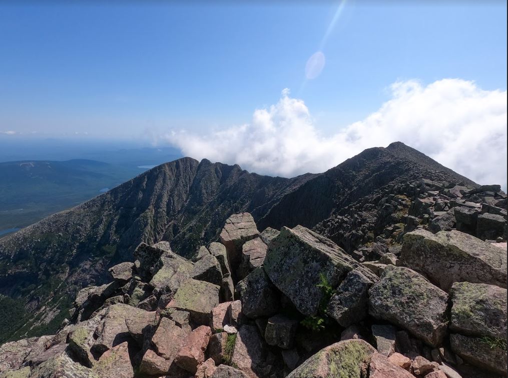
Knife’s Edge: This is a famous trail on the mountain where the drop offs are steep and the path is narrow. There are a few very steep spots where having a hiking buddy would be handy for a leg up. It is fine if you are by yourself but it is a more technical spot. This trail absolutely should not be done in bad weather. I would not even recommend it after recent rain or heavy wind.
This mountain is not easy, and the labeled easiest trails up are debated. Among the list of “easiest trails up” would be the Abol Trail, Hunt Trail, Saddle Trail and Hamlin Ridge. These don’t include your journey across the mountain and your way down.
Depending if you choose to do one peak and then descend, or do both peaks you will need to choose a trail to cross the ridge.
The Hunt Trail
Distance: 5.4 Miles
Elevation: 4,258 Feet
Trailhead: Katahdin Stream Campground
The Hunt Trail is roughly 5.4 miles from the parking area to Baxter Peak. If you choose this trail you get gradually worked into the steep climb as compared to the other trails where you jump right into the climb. Some people prefer to go up Hunt and come down Abol because of the openness of the Hunt Trail. Both the Abol and Hunt trails are on the back side of Mt. Katahdin.
Abol Trail
Distance: 4 Miles
Elevation: 3,969 Feet
Trailhead: Abol Campground
This trail also takes you up the backside of the mountain to Baxter peak and Pamola if you take Knife’s Edge over. It may seem like a short trail in terms of mileage but it will take about the same amount of time as the other trails. The trail was redone a few years back and is now a bit easier with the switchbacks that were added in. It is the most direct trail up and down.
Chimney Pond Trail
Distance: 3.1 Miles
Elevation: 1,463 Feet
Trailhead: Roaring Brook
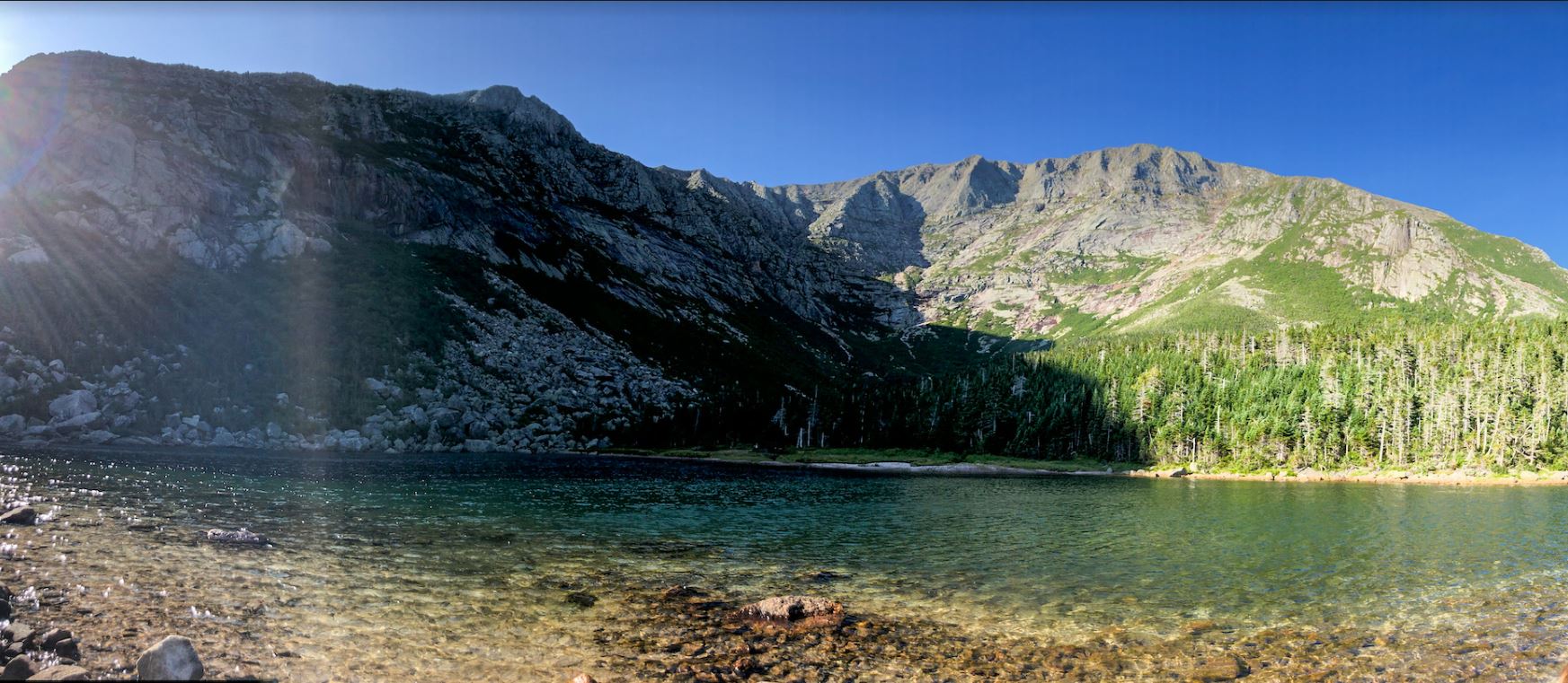
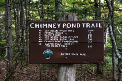
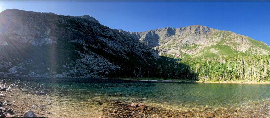
The Chimney Pond Trail is a connecting trail that takes you up to Chimney Pond, where a majority of the other trails connect. You can reach the Dudley, Hamlin Ridge, Saddle and Cathedral trails from the Chimney Pond trail. This is a beautiful hike alone, with great views of Mt.Katahdin overlooking the pond.


Helon Taylor
Distance: 3.8 Miles
Elevation: 3,937 Feet
Trailhead: Roaring Brook
Helon Taylor trail will take you directly to Pamola peak, and is the only other trail that will take you there besides Dudley or coming over from Knife’s Edge. The trail is mostly exposed and rocky, until you reach the treeline again.
Saddle
Distance: 2.1 Miles
Trailhead: Connect from Chimney Pond
Saddle is the easier pick of the two if you’re debating between taking Saddle of Cathedral to the summit. It is still quite steep but it follows the valley of the mountain to the top.
Cathedral
Distance: 1.7 Miles
Trailhead: Connects from Chimney Pond
I would vote that Cathedral is one of my favorite trails because of the difficulty. It is a lot of bouldering and heaving yourself over rocks. I would not recommend taking this trail if the weather isn’t great. I also wouldn’t take this trail on the descent unless you’re a glutton for punishment. Cathedral trail takes you to Baxter Peak.
Dudley
Distance: 1 mile
Trailhead: Connects to Chimney Pond
Dudley is similar to the Cathedral trail where you are bouldering and rock hopping, but it takes you to Pamola Peak versus Baxter Peak. This trail is occasionally closed, so be sure to make sure it is open before solidifying your plans.
Hamlin Ridge
Distance: Variable
Elevation: Variable
Trailhead: Connects to Chimney Pond
Take the Hamlin Ridge trail only if you want to include Hamlin peak in your trip. You will have to descend a little bit before resuming the climb to Baxter peak. You’ll connect with the Saddle trail before you reach Baxter peak. Hamlin peak is part of the New England 4,000 footer club.

Packing Must Haves
- Flashlight or headlight (Baxter requires it)
- First Aid Kit
- Adequate amount of water or life straw
- Sunscreen
- Hat
- SLEEVES-I got so sunburned wearing just a tank top
- GPS or Downloaded Maps
- Snacks-Ben burned 3200 calories and I burned 2600 calories on our hike
- A second pair of socks-Change them at the top
We hope that this guide will help you out when you’re planning your trip up Mt. Katahdin. If you have any questions that we didn’t cover or just anything else in general, drop them in the comments!